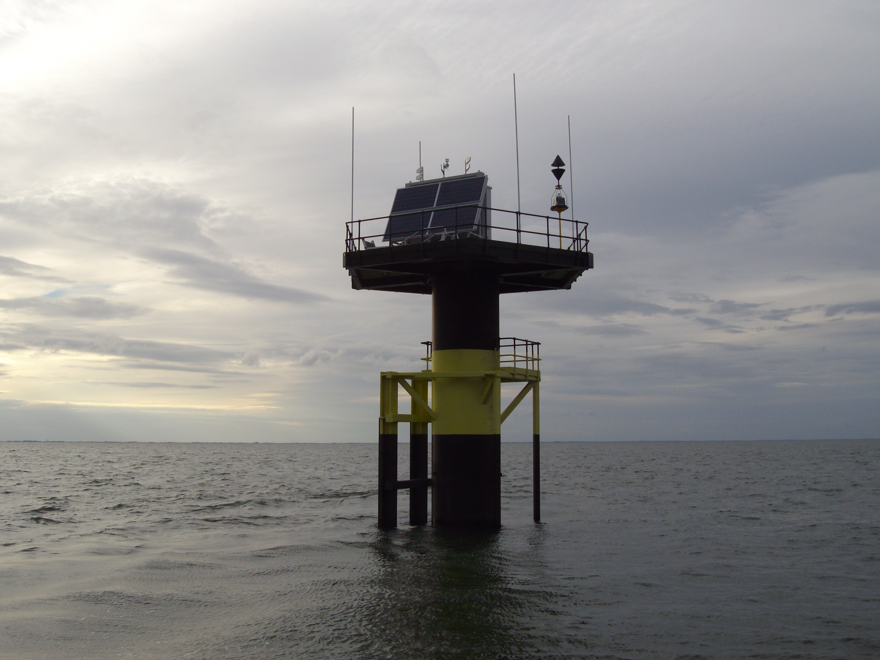
A newly-installed tidal gauge at Sutton Bridge has started collecting data that will help measure tides, predict flooding and assess the impact of climate change more accurately.
The project, which began last September and was finished in May, completes a national network of 44 gauges that record information about sea levels to provide more accurate forecasts.
The instrument is on a platform measuring about two meters across and 11 meters above sea level.
It’s located 4km offshore in The Wash close to the port of Sutton Bridge.
As well as collecting data for the Environment Agency, the gauge’s information on tide levels will also be used by the harbour authority to help boats navigate through The Wash.
Meteorological equipment on-board will measure wind speed and direction, and air pressure and temperature, and the Eastern Fisheries and Conservation Association (EFCA) also has equipment on the platform to measure the water quality and salinity.
Plus, the gauge will be used by the MoD as a static marker of the end of their testing range, where previously they had used floating buoys.
Claire Rose, flood and coastal risk management team leader at the Environment Agency, said: “This new gauge has a practical benefit for local communities as the information it gathers on sea levels will help us predict tidal surges and therefore improve our flood warning service.
“It’s a nationally important project, as it fills in the last gap in the UK’s monitoring network to give us the best picture of tidal conditions across the country.
“The gauge will prove invaluable throughout its 60-year lifetime by transmitting other important scientific data to a range of partner organisations.”
The £6m project was funded through Defra’s flood defence Grant In Aid scheme.