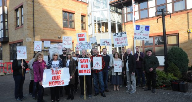
The council highways chief has said the recommendation to build the relief road at Bourne Road, which would mean the demolition of houses, as “difficult news for residents to hear”.
A council spokesman said: “Following an extensive, evidence-based options analysis process, officers have recommended a route through the centre of the ‘safeguarded corridor’ within the South East Lincolnshire Local Plan (see map).
“The route options study will be brought to the county council’s Highways and Transport Scrutiny Committee on Monday, December 9, with the county council’s Executive being asked to make a decision on the recommended route on Tuesday, January 7.
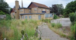
“If this route is taken forward by Executive, it would cross Bourne Road where five properties are currently located and would be built in close proximity to four others.”
Cllr Richard Davies, executive member for highways, said: “I know that identifying a recommended route hasn’t been an easy process and that officers have worked hard to technically assess the options.
“We also realise that, even though it is only an officer recommendation at this stage, the report’s outcome will be difficult news for the residents potentially affected to hear.
“We’ve written to residents on Bourne Road and Horseshoe Road within the ‘safeguarded corridor’ about the outcome of the study and will continue to stay in contact with them as things progress towards a final decision.”
Cllr Davies continued: “In order to bring Spalding’s relief road forward, we have to determine a route for it in the near future and have to receive and consider professional advice about where that route should go.
“I would like to reiterate that we have not yet made our decision and, even if the Executive approves the recommended route in January, work on the middle sections will not progress any further in the short-term.
“In fact, it could potentially be a decade or more before we start building this section of the relief road.
“Following the meeting of Executive early next year, we will reach out to the residents of Bourne Road and Horseshoe Road again to formally notify them of the outcome and outline what the next steps in the process will be.”
The options considered within the feasibility study were:
· Option 1: ‘Allotment Route’ to the far east and outside of the safeguarded corridor
· Option 1B: Bourne Road staggered junction
· Option 1C: easterly alignment along Monks House Lane to Bourne Road and south
· Option 2: easterly alignment within the safeguarded road corridor
· Option 3: central alignment within the safeguarded road corridor
· Option 4: through ‘Trojan Wood’ factory site to west, outside safeguarded corridor
· Option 5: A wide west alignment beyond Pode Hole
· Option 5A: A wide west alignment joining Dozen’s Bank
Cllr Davies added: “The study assesses eight different options and identifies the recommended route as the best one from a highway design perspective. It also identifies it as the most cost effective.
“The evidence within the study shows that the other options would all cost more to build than the recommended route, in addition to the land for the ‘allotment route’ already being allocated within the South East Lincolnshire Local Plan.
“Those are clearly very important things for us to consider in reaching our decision.”
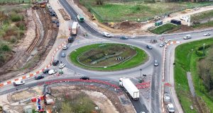
The Spalding Western Relief Road will provide a new route around the west side of the town, linking Spalding Common in the south to Spalding Road/Pinchbeck Road in the north.
The relief road will help reduce congestion and journey times in and around town as the area’s population, traffic levels and amount of rail freight passing through continues to grow.
For more information about the Spalding Western Relief Road, visit www.lincolnshire.gov.uk/swrr.