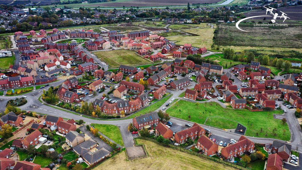
A drone operator is taking on a campaign to chronicle how Spalding looks from the air in 2020.
Steve Timewell, of Lincolnshire Drones, is taking aerial images of the town and surrounding villages as well as creating a video.
With the town and surrounding villages changing at an incredible pace, drone pilot Steve said: “I thought it would be good to make a permanent record of what our area looks like from above in 2020”.

His images have been well received on social media for all to enjoy and they have attracted huge attention and interest.
There’s a longer term aim to the project however.
At the same time, he is capturing video which will be edited into a 40-minute film about Spalding and surrounding villages in 2020.
Steve feels it’s really important to file a record of the town for future generations to see.

“I hope to have all the video captured by next March”, he said. “Then I can edit the whole film and release it for everyone to enjoy”.
As a commercial drone operator, Steve has to stick to the drone regulations.

Known as the ‘Drone Code’ it means he has to stay a certain safe distance from people and buildings.
He can however fly up to 400 feet which is more than enough to get a good idea on the town layout.
Lincolnshire Drones has full permissions from the Civil Aviation Authority to undertake commercial drone flights.

“I am particularly interested in capturing the areas that will be changing when the new bypass is built,” said Steve. “These areas will never be the same again”.